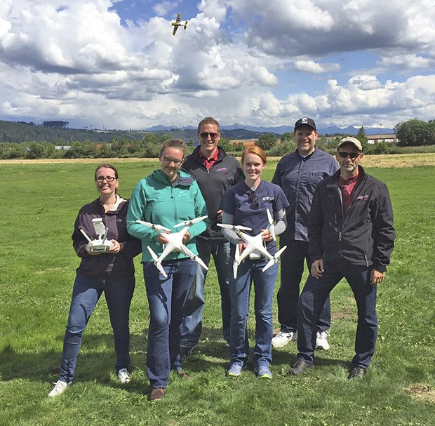
Some streams are so far out in the toolies Auburn inspectors can’t get to them.
Some towers so tall the City has to pay big bucks to somebody from outside to eyeball them.
Those are problems.
So, about a year ago City officials began to ask themselves: “How about putting a drone over that stream? Or flying one up to that tower to take videos? What about putting a drone up there to map this area to ensure we’re in compliance with regulations?”
On Monday, members of Auburn’s Information Technology team told the City Council they are ready roll out an unmanned aerial vehicle (UAV or drone) program to perform the sorts of jobs described above, among many others.
“We’re at a point now where we’ve been over the FAA regulations, and we are ready to launch,” said Ashley Riggs, the City’s Information Technology operations manager.
And, Riggs emphasized, to allay public fears of Big Brother in the sky, this program is to be strictly limited to civilian, not police, uses. It will operate under a stern set of rules specifying how information is collected, how it is stored and how public information that must be redacted is redacted.
For instance, the City has imposed a strict UAV speed limit of 22 miles per hour, and no drones will be allowed over private property, said City IT Director Paul Haugan.
“We’ve drawn a big line in the sand where we ready to go from that civilian side,” said Haugan.
Public safety, Haugan said, was key to the formulation of the program’s policies and standard-operating procedures.
“The reality is, drones crash,” Haugan said. “We know that. But just like we have people that drive trucks, we’re going to be flying drones. We wanted to make sure we had everything in place we possibly could to manage that risk effectively.”
Months ago, the City hired Rob Dannenberg, a consultant for the Portland, Ore.-based based branch of the internatial firm Cardno Engineering and Environmental Services, to get the program running. He described the equipment as two $1,600 drones, weighing 3.8 pounds each, carrying 4k cameras capable of capturing 4k video from which 14 megapixel still images can be extracted, and with the brawn to haul a 1 1/2 pound payload.
“It’s a small-to-medium-sized commerical platform,” Dannenberg said.
Well equipped
Each drone, Dannenberg continued, has a sonar and optical flow sensor on the bottom so the device can hold its position should GPS be lost, allowing those City employees who are piloting the UAV to return it to its takeoff location.
“As for sound, from 100 feet away it’s barely noticeable,” Dannenberg said. “If you stand next to it — and no one who isn’t participating in the activity will be doing that — it’s about the sound produced by most fans in people’s houses.”
“…We recognize the public is going to hear and see these, and we want to be proactive,” Haugan said. “So, any time after a flight plan is filed and the flight approved, we will notify police. Because if somebody sees one flying around, they are going to call. So we want police to understand, yes, this is an authorized City flight, here’s what we’re doing, everything is okay.”
Flying the drones will be six trained personnel, all to be among the first to complete the FAA’s new certification program when the government launches it in about six weeks. The upshot is that the operators will be federally licensed to fly the UAVs commercially. Until that license exists, each has a public waiver to fly without one.
In the works, advanced flying for autonomous missions — that is, training the pilots to program the UAVs so that once they have performed a mission they can return to the same spot and perform the mission again without an operator.
Small devices, according to Haugan, but with an outsized impact on risk management and dollars spent.
“We don’t have to have a body climbing up to a tower any more, we can fly a drone. Today it would take us $10,000 to $15,000 to hire that job out. Now, we can fly that drone for a $1,600 investment and the time Ashley’s team has spent building this program,” Haugan said. “There are additional things we could purchase, like software that makes the processing of whatever we gather easier, but as for now we are at $1,600.”
One of the concerns that launched the process a year ago, Haugan said, was stream management, or rather the City’s lack of ability to assess what’s happening with all of the streams out there.
“We know how the streams are changing and eroding into the hills and such, but there are spots we just can’t get to. So we have been paying consultants thousands and thousands of dollars to come out and take these photos and then process them to see how things are changing. This drone will do that for us now. We can go out and take time time-lapse things and have analysis based off those ourselves,” Haugan said.
Need alone will determine whether the program expands at some point in the future.
“We don’t want this to be a techology-for-technology’s-sake project; there has to be a definable business benefit to the City,” Haugan said.


