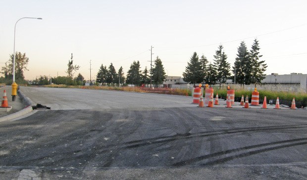
When the new, 1.47-mile-long connector tying together A and B streets northwest opens to traffic Aug. 24, a driver starting from the Auburn Transit Station will be able to tool all the way north to South 277th Street on a single road.
Along the way that driver will negotiate a new three- and four-lane road, with sidewalks between 3rd Street Northwest, immediately west of the Auburn Post Office, and 14th Street Northwest.
Basically, it will be a three-lane road from 3rd Street to 10th, and then from 10th to 14th it will widen out into a four-lane road. The only traffic signal going in will be at the intersection of 3rd and A Street.
Groundbreaking for the $9.7 million road construction project was July 18, 2011.
The A-B Street corridor connector is a byproduct of the Burlington Northern Santa Fe Railroad’s 1994 Stampede Pass Rail Impact Study, one of four projects in Auburn designed to mitigate the opening of the rail line. The other three were the 3rd Street grade and 277th grade separation projects and the M Street grade separation.
(Grade separation places the road surface and the railroad tracks at different levels.)
The Stampede Pass line is a secondary BNSF line that starts in downtown Auburn and climbs over the Cascade Mountains.
“You’ve got extremely slow trains using that line,” Traffic Engineer Ingrid Gaub told the Reporter recently. “The BNSF in 1993 reopened the line with the intention of eventually improving the tunnel over the mountains so it can take double-stacked trains through. When they do that, we will see more use of the line. When we did an analysis of all the at-grade crossings and of all the slow moving trains making the turn and getting onto the pass line, we ended up with about eight minutes of blockage through the downtown.”
City officials say the connector will improve access to the Post Office and facilitate the efficient movement of freight and goods.
“The A-B connector provides a parallel corridor to the BNSF mainline railroad on the east side, so you can connect from the downtown all the way to 15th Street Northwest, and from there all the way up to 277th,” Gaub said. “That means you can connect from the 3rd Street grade separation to the grade separation at 15th Northwest to the grade separation at 277th and never have to stop for trains. Right now, B Street ends at 14th Street near Taco Time, and to get into the downtown, you have to cut over and get onto A Street or 15th or onto Auburn Way.”
The federal government has contributed $6.5 million to the $9.7 million project. In-kind developer contributions total $1.3 million. That includes AMPAC Packaging and Mohawk Northern Plastics, which built a portion of the connector. Multicare, which owns property just south of 14th Street and is reported to be studying development options, added an in-kind contribution of $400,000.
The project includes the completion of approximately 22 acres of wetland mitigation in the City’s Auburn Environmental Park area.
Project pluses
A City of Auburn white paper on the project lists a number of benefits, including the following:
• It is part of a comprehensive downtown revitalization strategy that renews and expands the downtown core, a designated urban center.
• The 3.5 mile corridor accounts for 70 percent of the city’s projected job growth and supports the growth of more than 5,000 projected new jobs, for a total of 10,000 projected and existing jobs. It supports the development of more than 200 vacant and underdeveloped parcels along the corridor and in the downtown core.
• It increases access to South King County’s only Level 3 trauma center, the Auburn Regional Medical Center. The nearest Level 2 trauma centers are each 10 miles away, one north on SR 167, the other south on SR 512.
• It links the Auburn Transit Station to major retailers, employers and entertainment facilities.
• It provides a parallel route to Auburn Way and SR 167 that will reduce traffic congestion.


