For the Reporter
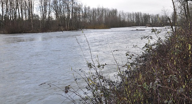
The Countyline Levee Setback Project – one of the most-complex public-safety projects in the nine-year history of the King County Flood Control District – is underway along the White River, where restoring the river’s access to its historic floodplain will help reduce the risk of flooding for hundreds of people living nearby.
It is the largest flood-risk reduction project in the history of the flood control district.
The project includes removing a constrictive levee along the White River and reconnecting the river to more than 120 acres of historic floodplain, which gives floodwaters more room to fan out and lose their erosive force. A new setback levee will be constructed to contain flows within the floodplain.
Project construction got underway in late May, and major construction will occur over the next two summer seasons.
County leaders were on hand in Pacific at a news conference Wednesday to hail the project.
“We celebrate an important milestone in providing improved flood protection for residents of King County and the City of Pacific living along the White River,” said Reagan Dunn, King County Council member and Flood Control District Board chair. “The Countyline Levee Setback Project has been an incredibly complex undertaking which successfully balances increased flood protection as well restoring vital habitat.”
“I am grateful for the tremendous effort given by all parties involved,” said Flood Control District Board Supervisor Pete von Reichbauer. “The Countyline project is the culmination of extensive public interest, and thousands of research hours by staff. This project will help to provide added safety and security for hundreds of residents along the White River for many years to come.”
Significant flooding in January 2009 impacted more than 100 residences and numerous businesses in the City of Pacific and temporarily closed Stewart Road East due to overtopping by floodwaters east of the 8th Street Bridge.
The project design takes into consideration long-term floodplain management as it accounts for the ongoing sediment deposition in this stretch of the White River, whose glacial source on Mount Rainier results in sand, gravel and rock all slowly moving downstream.
The complex project is a combination of property acquisition, levee removal, setback levee construction and floodplain restoration within the Countyline reach of the lower White River in the cities of Pacific and Sumner.
The project’s design received thorough review from a number of resource agency and tribal representatives. The White River is home to an imperiled population of rare Puget Sound spring chinook salmon.
A third-party review of the design was also completed, and the review resulted in modifications to the project design to help increase recreational boater safety through this stretch of the White River.
The project is unique in its technical complexity, diverse funding partnerships, multi-jurisdictional setting and multi-agency involvement. Project managers have successfully leveraged $6.1 million in funding to benefit habitat recovery, in addition to the $14.7 million funding provided by the flood control district.
The total project cost is estimated at $20.8 million with a number of funding sources:
• $14.7 million – King County Flood Control District;
• $4.8 million – Thea Foss Waterway Natural Resource Damage Assessment Settlement involving the following natural resource trustees: National Oceanic and Atmospheric Administration, United States Fish and Wildlife Service, the Washington State Department of Ecology, the Puyallup Tribe of Indians, and the Muckleshoot Indian Tribe;
• $823,000 – State Salmon Recovery Funding Board grant; and
• $500,000 – Pierce County funding.
For more information, visit kingcounty.gov/countyline-projects.


